After adding the quilombola communities of Rio Grande do Sul to the Interactive Road Map, the Autonomous Highway Department (Daer) began implementing the first improvements in access to these areas.
Last week, Luciano Faustino, general director of Daer, and Eliane dos Santos, Superintendent of Road Programming (SPR), met with mayor Paulino Salerno, of Restinga Seca, in the central region of the state, to discuss improvements to the ERS -149. The highway crosses the quilombola community of São Miguel, located in the municipality.
“The first step is to restore the highway signage with the help of the city hall. Afterwards, we will build a sidewalk along the stretch that crosses the community to ensure the safety of residents”, explains Faustino.
Currently, the municipality and the city hall are discussing the budget and deadlines for carrying out the works.
“This project is very important for us, as the community of São Miguel is divided by ERS-149, and there is a large flow of pedestrians in the area. There will be an improvement in road safety for both drivers and pedestrians. Everyone wants to improve the safety of local residents,” says the mayor.
Beco dos Colodianos receives the first signpost
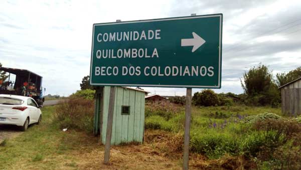
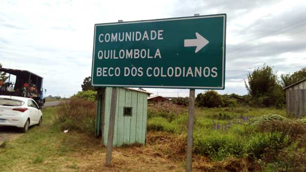
The first signpost for access to quilombola communities was installed last December, at the entrance to the Beco dos Colodianos community, in Mostardas, on the south coast. According to engineer Eliane dos Santos, author of the project “Improvements in access roads to quilombola communities”, the intention is to cover the entire state of Rio Grande do Sul.

“The goal is for the Secretariat of Logistics and Transport and Daer to develop a schedule for the other communities, in addition to installing indicative signs on state highways close to areas where there are quilombola communities. Regarding Restinga Seca, we will be carrying out a technical visit soon to evaluate the actions that will be implemented in the region, especially the improvements to ERS-149”, comments Eliane.
According to the National Institute of Colonization and Agrarian Reform (Incra), there are 146 quilombola communities in Rio Grande do Sul. Of these, 131 are certified and were the first to be included in the map prepared by Daer. With this identification, people in these areas will have an important tool to overcome the barrier of lack of information about them. Among the data are the names of the communities, the number of families, the certification processes at Fundação Cultural Palmares and titling at Incra, the location of the municipality, the region of the Regional Development Council (Corede), the functional region, the coordinates and the regional superintendency of Daer to which the municipalities belong.
Soon, new information, such as photos and community pages on the internet, will also be added. Data for updates will be provided by the Rio Grande do Sul Technical Assistance and Rural Extension Company (Emater/RS) and the Rural Development Secretariat (SDR).
O Interactive Road Map of RS can be accessed by the general public and transport technicians at the link mapa.daer.rs.gov.br.


